
Hyperspectral vs Multispectral Imaging: Choosing the Right Earth Observation Technology

Earth observation has evolved significantly over the past few decades, from capturing simple satellite images to delivering rich datasets that power Earth intelligence. By collecting information across different regions of the electromagnetic spectrum, modern satellites reveal the physical and chemical properties of the Earth's surface, enabling applications ranging from land cover mapping and disaster response to precision agriculture, mining, and environmental monitoring.
Among the most widely used imaging technologies are Multispectral Imaging (MSI) and Hyperspectral Imaging (HSI). While both capture reflected light across multiple wavelengths, they differ in the amount of spectral information they collect and the level of detail they provide. Understanding these differences is key to choosing the right technology for a given application.
Understanding the Electromagnetic Spectrum
Satellites observe the Earth by measuring sunlight reflected from its surface across different regions of the electromagnetic spectrum. As light interacts with materials such as vegetation, water, soil, and minerals, each produces a unique spectral signature based on how it reflects and absorbs different wavelengths.
The amount of spectral detail a sensor captures is determined by its spectral resolution, the number and width of the wavelength bands it measures. Multispectral sensors capture a limited number of broad spectral bands, providing an overview of surface characteristics, while hyperspectral sensors capture hundreds of narrow, contiguous bands, preserving subtle spectral features that enable precise material identification and deeper analysis.
Most Earth observation sensors operate within three key regions:
- Visible (VIS): 400–700 nm
- Near Infrared (NIR): 700–1000 nm
- Short-Wave Infrared (SWIR): 1000–2500 nm

MSI vs. HSI: Key Differences
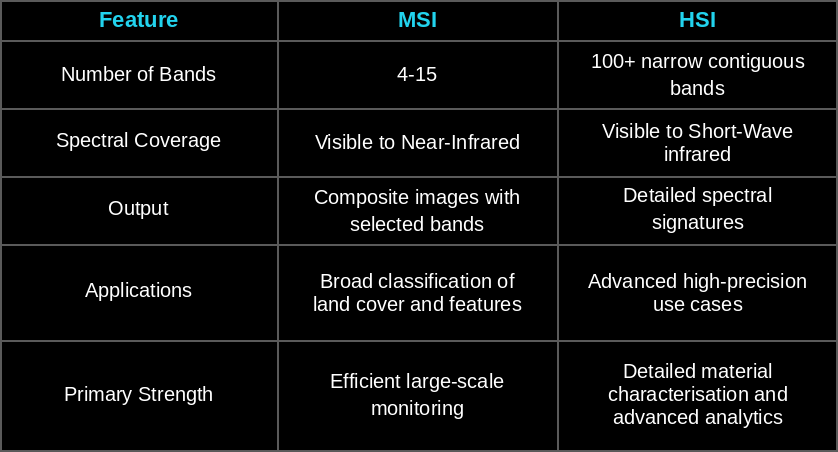
Choosing the Right Technology
Selecting the right imaging technology begins with understanding the level of information needed to make confident decisions.
Multispectral imaging is ideal for large-scale monitoring and mapping, capturing a limited number of broad spectral bands to efficiently track land cover, vegetation, water bodies, urban growth, and environmental change. It provides reliable insights where identifying broad patterns and conditions is sufficient.
Hyperspectral imaging goes a step further by capturing hundreds of narrow, contiguous spectral bands, creating a unique spectral signature for every pixel. This enables precise material identification and reveals subtle differences in physical and chemical properties, making it a perfect choice for applications such as mineral exploration, crop health assessment, water quality monitoring, and environmental analysis.
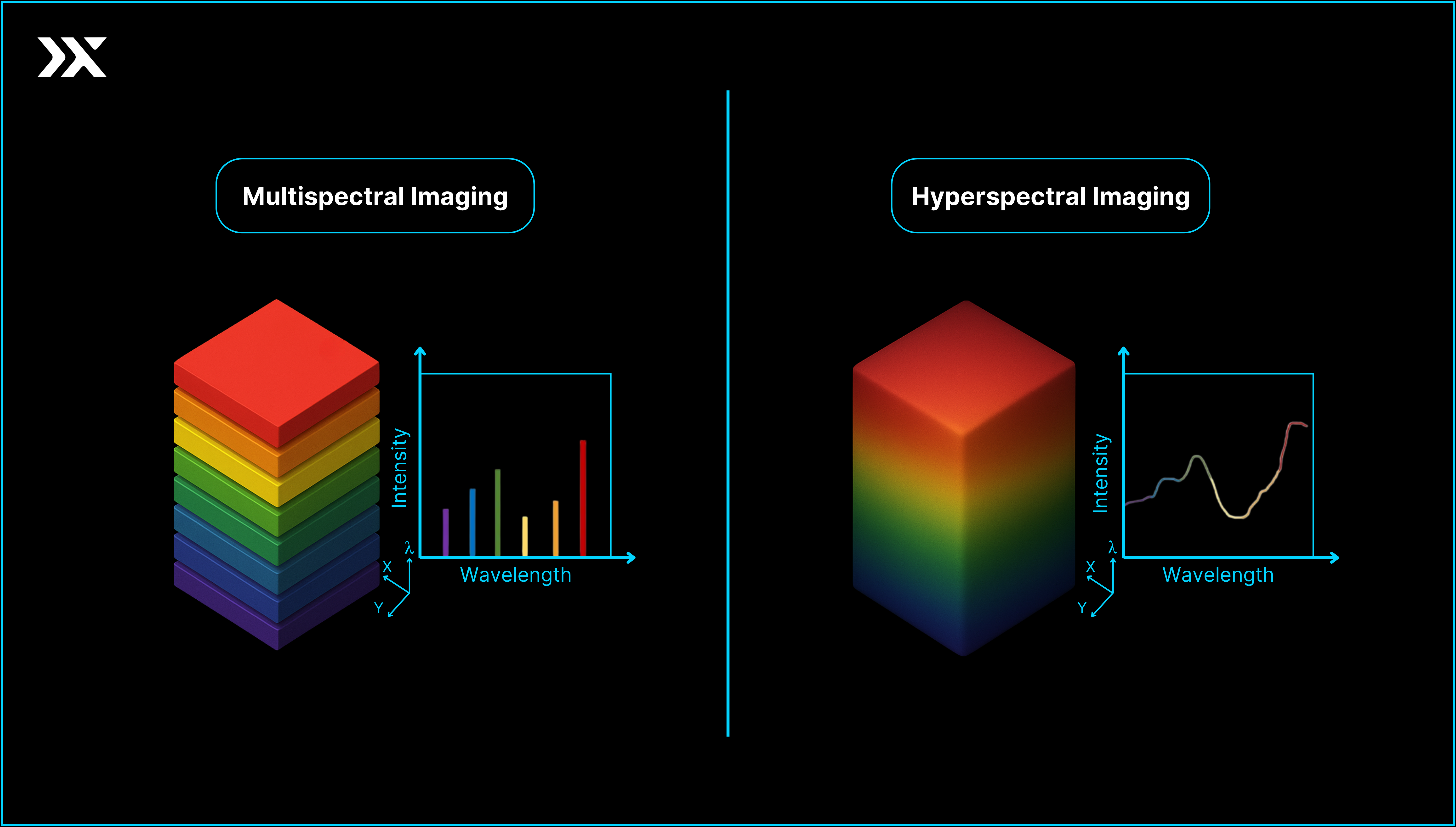
The table highlights key use cases across different industries, comparing the capabilities of multispectral imaging (MSI) and hyperspectral imaging (HSI). While MSI is well-suited for large-scale monitoring, HSI addresses all MSI use cases while providing deeper insights through rich spectral information.
.png)
As Earth observation advances, understanding the strengths of each technology ensures you can choose the right data to turn observations into actionable insights.
Every application is unique, and so are its data requirements. Get in touch with us to discover how hyperspectral imaging can help solve your organisation's most complex challenges and deliver actionable Earth observation insights.


.png)
