ENVIRONMENT
Boost Climate Resilience with Timely Insights from Pixxel’s Hyperspectral Satellites
Utilise Pixxel’s hyperspectral data for efficient biodiversity mapping, water quality monitoring, carbon sequestration, and optimised environmental protection.

Pixxel’s hyperspectral satellites capture unique spectral information globally at high spatial and temporal resolutions. With Pixxel, organisations and researchers are empowered to make informed decisions that support climate resilience, preserve natural resources, and advance sustainable environmental stewardship.


Addressing Environmental Monitoring's Challenges
The environmental sector is challenged by harmful practices and insufficient efforts to preserve the planet, which impede the ecosystem and climate. Implementing advanced technologies and data-powered solutions helps ensure timely management of these issues.

Biodiversity and
Ecosystem Health
Monoculture afforestation and invasive species reduce biodiversity and ecosystem resilience, weaken natural habitats, and increase vulnerability to environmental changes.
Monitoring
and Enforcement
Ineffective oversight of illegal logging and forest fires contributes to habitat destruction, accelerating deforestation and inefficient land use planning.
Resource Management
and Sustainability
Unsustainable resource extraction practices disrupt ecological balance, causing long-term environmental degradation, reduced economic viability, and harm to social welfare.
Water Quality
and Pollution Control
If unchecked, industrial and agricultural pollutants degrade water quality, compromising public health and causing ecological damage.
Discover the
Hyperspectral Advantage
Hyperspectral imaging enables detailed identification of environmental parameters through its high spectral resolution and narrow wavelength bands, spectrally fingerprinting the Earth to provide more information about their physical and chemical properties than is possible with multispectral imaging.
With distinct spectral signature analysis, hyperspectral imaging identifies pollutants, monitors ecosystems, and distinguishes habitat features.

5-metre spatial resolution

250+ VNIR and SWIR bands

24-hour revisit frequency

40-kilometre SWATH width
.png)
.png)
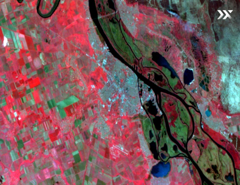
Climate Resilience in Action
Hyperspectral Applications
For A Changing Planet
Data-driven and sustainable
environmental practices
The frequency and spectral fidelity of Pixxel’s hyperspectral imaging technology enable accurate species detection. Adopting accurate species boundary maps can help reduce costs, allocate resources efficiently, and improve the overall environmental management process while helping to regenerate different habitats.


Pixxel’s hyperspectral solutions for carbon estimation
Hyperspectral imaging captures 10x more data, showing exceptional functionality in carbon estimation for environment management applications.
This facilitates targeted strategies to optimise sustainable environmental management practices including:
- carbon sequestration
- emission monitoring, and
- ecosystem health assessment.

Early pest and disease detection with Pixxel’s hyperspectral solutions
High spectral resolutions and frequent revisit rates are essential features of Pixxel’s hyperspectral imaging technology, proving vital in detecting and forecasting pest infestations and environmental diseases. Access to hyperspectral data enables environmental managers to experiment and monitor ecosystems against different stressors, facilitating proactive measures for sustained environmental health.

Streamlined water quality monitoring and management
Pixxel’s 5-metre spatial resolution satellite imagery provides accurate data on surface waters' biochemical and biophysical composition.
- Track water quality parameters including chlorophyll content, suspended sediments, and oxygen levels.
- Detect pollutants and contaminants with unparalleled accuracy.
- Support early warning systems for Harmful Algal Blooms (HABs).

Real World Impact
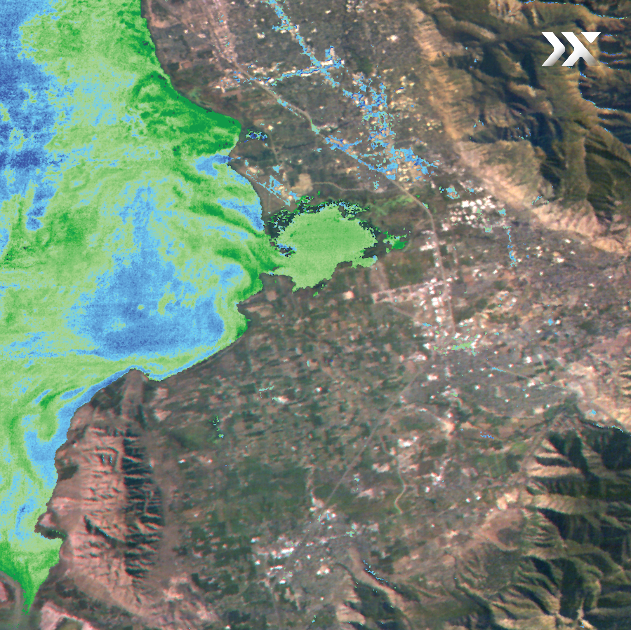
Monitoring Water Quality
In Utah Lake
Pixxel’s hyperspectral imaging is revolutionising water quality management in Utah Lake, where harmful algal blooms pose significant threats to aquatic ecosystems and public health. Through fine spectral details, Pixxel’s imagery enables precise detection and monitoring of water quality parameters, helping identify early warning signs of contamination.

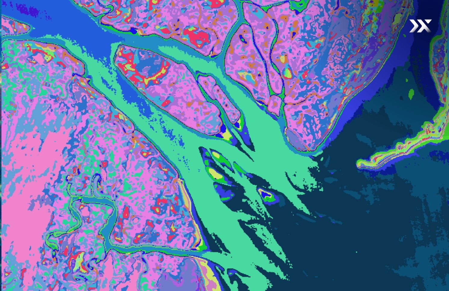
Mangrove Species Classification
in The Saloum delta
Pixxel’s hyperspectral imaging is transforming how we monitor coastal ecosystems, enabling detailed mapping and classification of mangrove species. By capturing fine spectral variations, the data helps identify subtle differences between species—crucial for assessing biodiversity, tracking habitat health, and supporting blue carbon initiatives.


Knowledge Hub
Discover how Pixxel’s Earth Observation data enables proactive environmental monitoring and resilience.